€8.99*
Content: 1 Stück
Available, delivery time: 2-5 days
Total: *
Savings: *
Product number: 1025
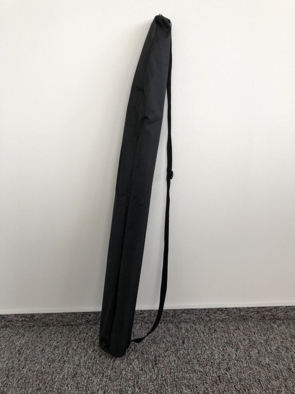
Product information "Bag for tripod with shoulder strap 80 cm length"
Bag for tripod with shoulder strap 80 cm length
- Inside length: approx. 80 cm
- Inside width: 6-7 x -6-7 cm
- Colour: Black
- belt lenght: up to 85 cm
Skip product gallery
Similar products
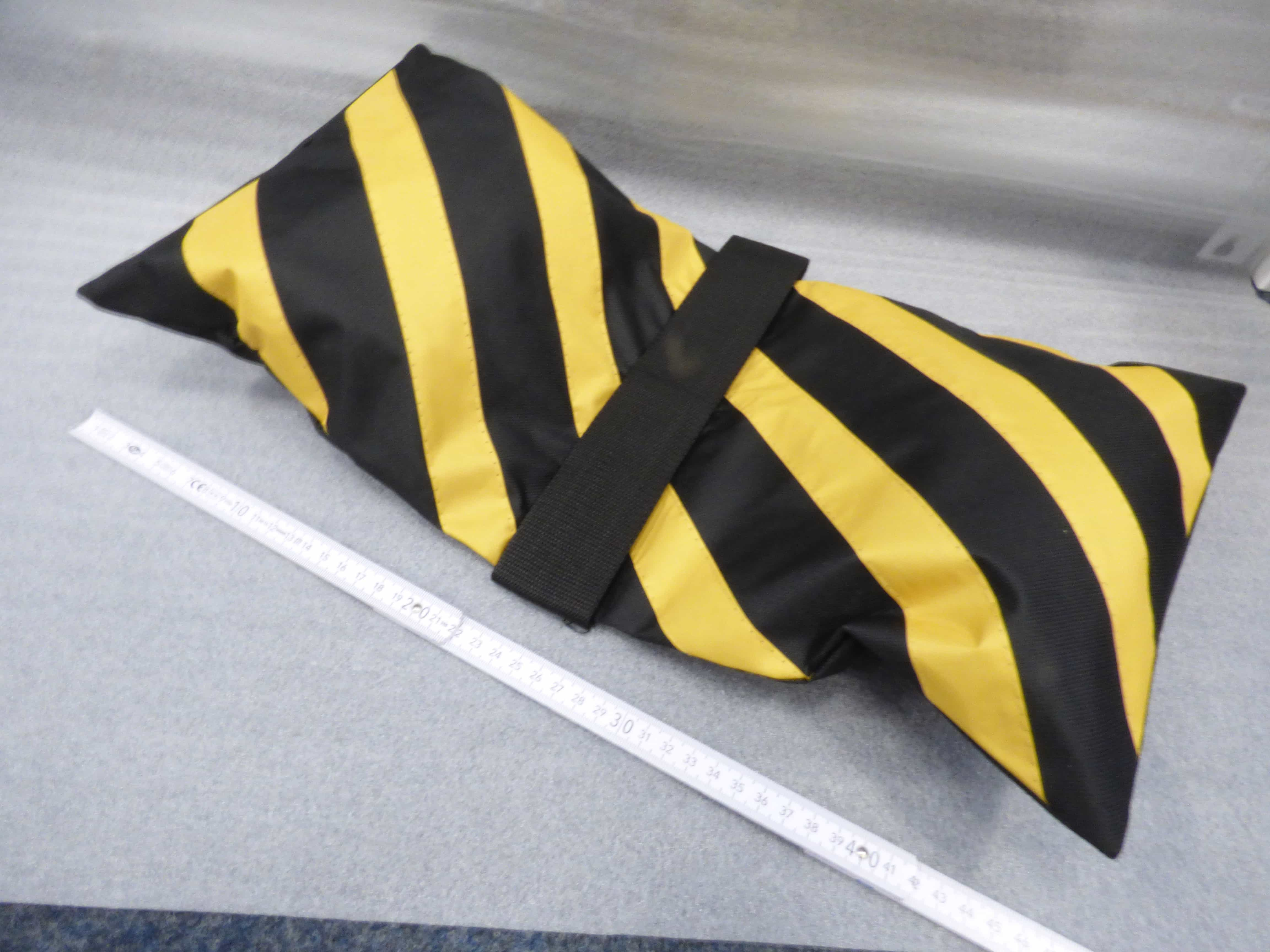
Counterweight - sandbag for tripods
Counterweight - sandbag for tripods Dimensions: 23 x 50 cm Maximum total weight of sand: 8 Kilo (4 Kilo per bag) Sand is not included !
€13.95*
Skip product gallery
Customers also bought
NetAlly AirMagnet Survey PRO Wireless Site Survey Software (includes Planner Modules)
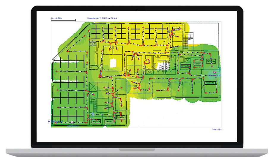
AirMagnet Survey PRO enables network professionals to design, deploy and validate WiFi 6 wireless LAN networks for optimal performance, security and compliance. It also calculates the ideal quantity, placement and configuration of access points for a successful wireless LAN deployment. AirMagnet Survey PRO goes beyond simply verifying RF coverage by plotting actual end-user network performance in terms of connection speed, throughput and packet statistics by allowing you to use any WiFi adapter or AirMapper Site Survey on the AirCheck G2 and EtherScope nXG. AirMagnet Survey PRO helps you get WiFi installations right the first time, preventing costly rework and user complaints. Plan and design WiFi networks without physically rolling out any access points Collect real world data by performing true end-user experience measurements using any WiFi adapter or AirMapper Site Survey on the AirCheck G2 and EtherScope nXG Generate heatmaps that provide full visibility of WiFi coverage, noise SNR, interference, throughput, data rates, retries, loss, Voice-Over-WiFi MOS and more Save time by performing active, passive and spectrum survey in a single walk-through Key Features WiFi 6 Site Survey AirMagnet Surve PRO is a wireless network deployment solution that enables users to measure and assess the true end-user experience of a wireless network using any 802.11 adapter or AirMapper Site Survey on the AirCheck G2 and EtherScope nXG. AirMagnet Survey PRO goes beyong just verifying RF coverage and plots actual end-suer network performance, in terms of throughput and PHY data rates, while taking MU-MIMO and other environmental situations/network configurations into account. The wireless site survey solution reveals the coverage of specific 802.11 parameters that impact perfromance, such as higher MCS schemes and wider channel and intrusion of interference or legacy devices. Results are displayed as a complete WiFi "weather map" of all critical RF and end-user performance metrics. The accountability of "real world" measurements allow IT staff to design and deploy WiFi accurately from start. Helping businesses save time and money, reducing end-user network complaints and recuding costly redesigns of the network. Integration with AirMagnet Planner AirMagnet Planner is built into AirMagnet Survey PRO, providing a single, seamless application as one of the industry´s most complete approaches to wireless LAN design, deployment and ongoing optimization for WiFi 6 networks. With this integrated solution, AirMagnet Planner can be used to accurately design WLANs by modeling building construction materials/obstructions, 802.11 access points and visualizing coverage across multiple floors, then validating the results with real-world data in AirMagnet Survey PRO. Using active end-user performance metrics, users can further perfect their planning models over time. Users also gain additional planning capabilities with the ability to test network plans against the AirWise engine for design requirements. AirMagnet Planner also integrates with AirMagnet Survey Express. "Realworld" Survey Data Collection and Solution of "What-If" Scenarios With the AirMapper app on the AirCheck G2 or EtherScope nXG users can quickly and easily gather location-based WiFi measurements and create visual heat maps of key performance metrics in AirMagnet Survey PRO. Simple to use, the AirMapper app is ideal for quick site surveys of new deployments, change validation and performance verfification. Complete faster and easier WiFi site surveys with an entirely mobile platform Perform enterprise-grade surveys without the need of a dongle or tethered device Collaborate - easily visualize and share survey data through Link-Live cloud service or AirMagnet Survey PRO AirMagnet Survey´s simultaneous wireless site surveying capability leverages multiple adapters plugged into the same PC to provide users with a solution that emulates real-world client behavior (using active and iPerf surveys). Having an accurate wireless emulator tool reduces site surveying time and efforts, cuts cost by half and requires users to walk the floor only once to collect all required data. With this wireless 802.11 site survey tool, users can create "what-if" scenaros to simulate a variety of changes to the network and preview the impacts. Options include changing access point transmit power, channel, SSID settings and the addition of environmental noise. Users can also simulate moving access points to new locations and preview the effect of adding additional access points. AirMagnet Survey PRO empowers users with the option of creating an automated channel plan for access points that avoids interference and over-allocation. Outdoor Wireless Site Surveys With GPS support and integration with Google Earth, AirMagnet Survey PRO provides fully-automated outdoor wireless site surveys. Users can leverage NMAE-compliant GPS devices to automatically collect outdoor wireless data. Users also can import street maps of any city in the world, and have the option to analyze results within the AirMagnet Survey user interface or exported into Google Earth for a zoomed-in view to any street within the city. RF Spectrum and Voice-over-WLAN Surveys Beforem making any design and deployment decisions, users can account for RF interference from non-WiFi devices. Users who own AirMagnet Spectrum XT can collect both WiFi and spectrum analysis data in a single survey and integrate the data into AirMagnet Survey. With this integration, users can visualize the RF energy at any location and identify/display the presence of non-802.11 devices interfering with the WLAN. AirMagnet Survey addresses the challenges faced by network installers and IT staff when deploying VoWLAN networks. With a built-in voice readiness verification system, AirMagnet Survey allow users to ensure that their network design is aligned with the recommendations of the phone vendor. This system also allow users to perform real-world voice surveys by validating and plotting phone call quality, capacity and other voice specific parameters at every location on a floor map helping to identify and minimize issues. Validate user and Application Requirements The AirWise engine allows users to set wireless network design/application requirements, such as signal coverage, wireless network throughput, PHY data rates, 802.11 specific parameters and more to help identify any problem areas. Once set, users are alerted to the areas on the floor map that meet, or do not meet the requirement, enabling them to take the necessary action to solve the coverage, performance or capacity problems. AirWise includes the option to create profiles based on real-world survey data or wireless network modeling data that can be used to verify WLAN deployment readiness for a variety of applications. This single-click assessment of the WLAN network helps save time, effort and money by avoiding costly re-designs of the WLAN network and minimize IT troubleshooting costs. Users can generate a Pass/Fail report that enables an efficient hand-over of results of the survey to the installer or the end-customer. Professional Custom Reports AirMagnet Survey PRO includes a completely integrated reporting module that instantly creates custom outputs of site survey and simulations. Customized templates provide wireless 802.11 site survey users with flexibility by creating various reports based on project requirements. Users can customize reports further by including/excluding sections, adding in notes and customizing logos, headers and footers amongst many other customizable options. Reports can be saved in multiple formats, such as PDF, XML, HTML, Excel or Word. Visualize Coverage and Performance Differences Over Time WiFi environments are very dynamic and to guarantee the best performance for end-users, it is important to be able to verify changes in coverage and performance in the network. AirMagnet Survey´s Diff View feature allows side-by-side visualization of differences between two separate surveys. The Diff View feature helps display how a site´s wireless environment has changed over time. This view is a great tool for System Integrators to drive repeat business of validating the coverage and performance of the network on an on-going basis. Likewise, users can use this feature to quickly compare AirMagnet Planner results with actual site survey results. This information can the be used to fine-tune the dl losses for the building and environmental conditions within Planner for more accurate planning. Integration with WLAN Infrastructure Vendors AirMagnet Survey allows exporting of real-world survey data to Cisco Prime. This is critical for, not only calibrating Cisco´s built-on planner modeling capabilities but also for specialized applications. For example, location services that mandate a calibration site survey for maximizing location accuracy for WLAN clients, or tags and VoWLAN servics that recommend the use of site surveys to validate real-world data versus the predictive capabilities of the infrastructure. Take advantage of the planning capabilities built inside AirMagnet Survey PRO by creating and exporting planner projects directly into Cisco Prime. This integration eliminates the need to repeat these tasks within Cisco Prime, saving users time and resources needed, in setting up of maps, access point placement locations and other WLAN deployment modeling activities. System Requirements for Laptop/Notebook/PC/Tablet PC: Operating Systems: Microsoft Window 8.1 Pro / Enterprise 64 bit or Windows 10 Pro / Enterprise 64 bit Intel Core 2 Duo 2.00 GHz (Intel COre i5 or higher recommended) 4 GB or higher 800 MB free hard disk space USB port or multiple ports in the PC when using multiple adapters AirMagnet-supported wireless network adapter(s) or AirCheck G2/EtherScope nXG with AirMapper (recommended) Optional: AirMagnet Spectrum XT Adapter and license (required for viewing spectrum data and heat map; Survey PRO only) A site map in a format supported by AirMagnet Survey (supported formats are: .bmp, .dib, .dwg, .dxf, .emf, .gif, vsd, .jpg, .wmf, .vdx or .png Google Earth must be installed in order to export the GPS data for outdoor surveys to Google Earth (Survey PRO only) Supported GPS device. Here is a list of GPS devices that have been approved for use with the AirMaget Survey product: Gamin eTrex LEGEND HCx Garmin eTrex Garmin eTrex Legend Garmin GPS18X USB Garmin GPS 18 Deluxe Microsoft GPS-500 SIRF III DeLorme Earthmate GPS LT-20 Magellan eXplorist 500 Pharos iGPS-180 US GlobalSat Buz-353-S4 (recommended) System Requirements for Apple Macbook PRO: Operating Systems: MAC OS X v10.5 (Leopard) or higher running a supported Windows OS (as noted under Laptop/Notebook/PC/Tablet PC section) using Boot Camp Intel based CPU 1.6 GHz or higher 4 GB or higher 800 MB free hard disk space USB Port or multiple ports when using multiple adapters AirMagnet-supported wireless network adapter(s) or AircheckG2/EtherScope nXG with AirMapper (recommended) Optional, AirMagnet Spectrum XT Adapter and license (required for viewing spectrum data and heat map; Survey PRO only) A site map in a format supported by AirMagnet Survey (supported formats are: .bmp, .dib, .dwg, .dxf, .emf, .gif, vsd, .jpg, .wmf, .vdx or .png) Google Earth must be installed in order to export the GPS data for outdoor surveys to Google Earth (Survey PRO only) Supported GPS device. Here is a list of GPS devices that have been approved for use with the AirMagnet Survey product: Garmin eTrex LEGEND HCx Garmin eTrex Garmin eTrex Legend Garmin GPS 18 Deluxe Garmin GPS18X USB Microsoft GPS-500 SIRF III Garmin GPSMap 60 DeLorme Earthmate GPS LT-2 DeLorme Earthmate GPS LT-40 Magellan eXplorist 500 Pharos iGPS-180 US GlobalSat BU-353-S4 (recommended) Supported Adapters: AirMagnet Survey supports two categories of wireless adapters: Preferred Adapters: These adapters have been comprehensively tested by AirMagnet and are recommended for use with AirMagnet Survey PRO. Drivers have been customized for extended feature support. Visit netally.com/products/airmagnet-survey-pro Other Adapters: These adapters can be used with AirMagnet Survey PRO but have not been tested by AirMagnet. Drivers have not been customized, will provide limited features and could provide inaccurate data Note: NetAlly is not responsible for the quality of the test results collected using WiFi adapters not included on the Preferred category. Authentications supported by various adapters vould be limited by their own capabilities, Windows wireless zero configurations and various other reasons.Available downloads: AirMagnet Survey PRO Data Sheet Site Survey Best Practices - White Paper 802.11 USB Adapter FL 20 V2 AirMagnet Survey PRO Preferred Adapters AirMagnet Survey PRO Comparison Table
Price on request
Skip product gallery
Customers also viewed
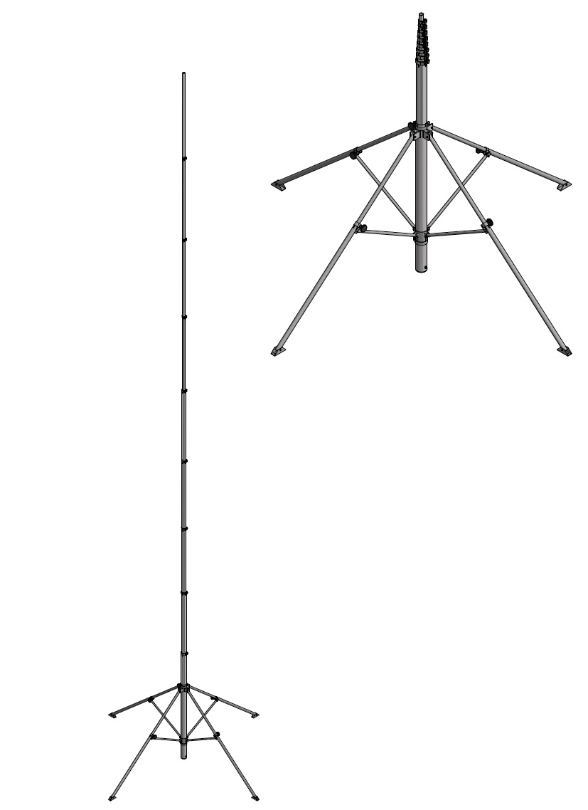
Aluminium tripod, black anodised pushed out length 10,50 Meter
This aluminium high tripod is manufactured by a family owned factory in Germany. With an extended length of 10.50 meter and a load capacity of up to 8 kilos, the aluminium high tripod is perfect for WiFi Site Surveys in logistic warehouses, various types of factories and distribution centres. Due ot the inserted length of 1.90 meter and a transport weight of approx. 28 kilos, this aluminium high tripod is very easy to transport. The aluminium high stand consists of an aluminium round mast to which four feet are attached. The individual feet are telescopic so that small unevennesses in the terrain can be compensated. The round masts consist of several aluminium tubes that are inserted into each other and polished on one side and pushed out by hand. The sturdy clamps securely lock the extended tubes in place. The maximum permissble extension lenght is limited by a marking ring. There is no fixed stop when pulling out. There are two markings for safety. When the first mark is reached, the telescopic tube should then be slowly pushed out to the second mark and locked in place by the clamp when this is reached. The aluminium high tripod and the round mast are made of anodised aluminium round tubes (AlMgSi05 F22) with a 2 mm wall thickness. The own weight is approx. 28 kilos and is therefore very low. ** Note: When using the aluminium high tripod with a head load, bracing must be carried out depending on the existing wind conditions.** Aluminium high tripod, black anodised 10.50 metres extended height Inserted length: 1.90 metres Extended length: 10.50 metres Colour: black anodised Tube diameter (mm): 70/65/60/55/50/45/40 Material: Aluminium Load capacity: up to 8 Kilo Transport weight: approx. 28 Kilo Head: 1/4" photo thread (removable) Country of origin: Germany
€1,957.55*


